Vertical Reference Systems
IAG Symposium Cartagena, Colombia, February 20–23, 2001
AvHermann Drewes,Alan H. Dodson
Del i serien International Association of Geodesy Symposia
2 182 kr
Beställningsvara. Skickas inom 10-15 vardagar. Fri frakt över 249 kr.
Fler format och utgåvor
Beskrivning
Produktinformation
- Utgivningsdatum:2002-08-06
- Mått:193 x 270 mm
- Vikt:1 187 g
- Format:Inbunden
- Språk:Engelska
- Serie:International Association of Geodesy Symposia
- Antal sidor:355
- Upplaga:2002
- Förlag:Springer-Verlag Berlin and Heidelberg GmbH & Co. KG
- ISBN:9783540430117
Utforska kategorier
Innehållsförteckning
- The cooperation between IAG and PAIGH.- Velocity estimates of IGS RNAAC SIRGAS stations.- The vertical reference system in the Argentine Republic.- Improvements in the ellipsoidal heights of the Argentine reference frame.- Brazilian first order levelling network.- The vertical geodetic network in Chile.- Approach to the new vertical reference system for Colombia.- Vertical control networks in Indonesia.- Current status of vertical control network in Peninsular Malaysia and plans for adjustment.- Vertical geodetic network of Mexico.- The new height system in Switzerland.- Subsidence of the permanent GPS station Bogotá.- Time series analysis of the daily solutions of the AGRS.NL reference stations.- Vertical motions from geodetic and geological data: a critical discussion of the results.- Central European vertical and kinematic systems.- Advances in the calculation of a height transformation model in Buenos Aires Province.- Estimation of station heights with GPS.- Contribution of individual space techniques to the realization of vertical reference systems.- Analysis of time series of GPS height estimates with regard to atmospheric pressure loading.- The impact of antenna radomes on height estimates in regional GPS networks.- Influence of tropospheric zenith delays obtained by GPS and VLBI on station heights.- A study on the effects of data accuracy and datum inconsistencies on relative GPS levelling.- Employing the strict kinematic model for the maintenance of a height reference frame based on conventional levellings.- Minimising the error budget in the third precise levelling of Sweden.- The influence of gravity variations on leveled heights.- Motorised levelling — the ultimate tool for production of classic national height networks.- New results in the determinationof the geoid model in Argentina.- Data collecting and processing for quasi-geoid determination in Brazil.- Improving the quasigeoid model in Colombia.- Isostatic anomaly maps for Colombia.- Project to refine the geoidal solution in the Mexican area.- The vertical datum and local geoid models in Uruguay.- One approach to determine the geoid local trend at Montevideo area.- Current status of geoid calculation in Venezuela.- Geoidal undulations from GPS measurements in Venezuela.- Geoid study in Tierra del Fuego.- Preliminary geoid model for Tierra del Fuego.- Using a “GPS/MSL geoid” to test geoid models in the UK.- Online and postprocessed GPS-heighting based on the concept of a digital height reference surface (DFHRS).- General scheme for the computation of regional geoid undulations using spherical wavelets.- Predicting free-air gravity anomaly using artificial neural network.- Local geoid models — practical considerations.- The sea surface topography and its impact to global height system definition.- Correlation between multi-mission altimeter time series and tide gauge registrations in the Caribbean sea.- The EVAMARIA project: Identification and verification of sea level anomalies in the North Atlantic.- Vertical crustal movements of tide gauges sites around the North Atlantic Ocean.- Caribbean sea level variability from TOPEX/Poseidon altimetry.- Monitoring tide gauges benchmarks in Argentina by GPS.- Mean sea level and sea surface variability of Indonesian waters from TOPEX/Poseidon.- Using GPS to separate crustal movements and sea level changes at tide gauges in the UK.- Towards a globally consistent nautical chart datum definition in France.- The 3-D coastline of the new millenium (managing datums in n-dimension space).- Geoid variations due to mean sealevel variations.- World height system specified by geopotential at tide gauge stations.- Scientific foundations of the SIRGAS vertical reference system.- The vertical reference frame for the Americas — The SIRGAS 2000 GPS campaign.- Preliminary results of SIRGAS 2000 campaign — IBGE analysis center.- Processing of the SIRGAS 2000 GPS network at DGFI.- Associated problems to link South American vertical networks and possible approaches to face them.- Connection of the vertical control networks of Venezuela, Brazil and Colombia.- Attempts to unify the Australian height datum between the Mainland and Tasmania.- Towards the establishment of an Indonesian unified vertical datum.- Determination of a unified height reference system for the computation of a local geoid around the volcanoes Merapi and Merbabu, Java, Indonesia.- The vertical reference system for Europe.- Cartagena Statement on Vertical Reference Systems.
Mer från samma författare
Towards an Integrated Global Geodetic Observing System (IGGOS)
Helmut Hornik, Wolfgang Bosch, Hermann Drewes, Reinhard Rummel
1 449 kr
Towards an Integrated Global Geodetic Observing System (IGGOS)
Reinhard Rummel, Hermann Drewes, Wolfgang Bosch, Helmut Hornik
Häftad, 2011
1 095 kr
Mer från samma serie
Kinematic Systems in Geodesy, Surveying, and Remote Sensing
Klaus-Peter Schwarz, Gerard Lachapelle
Häftad, 1991
1 638 kr
From Mars to Greenland: Charting Gravity With Space and Airborne Instruments
Oscar L. Colombo
Häftad, 1992
1 095 kr

International Symposium on Advancing Geodesy in a Changing World
Jeffrey T. Freymueller, Laura Sánchez
Inbunden, 2019
1 637 kr
Du kanske också är intresserad av
Vertical Reference Systems
Pedro Sandoval, Laura Sanchez, Luiz P.S. Fortes, Alan H. Dodson, Hermann Drewes
2 925 kr
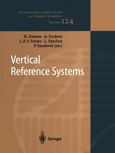
Vertical Reference Systems
Hermann Drewes, Alan H. Dodson, Luiz P.S. Fortes, Laura Sanchez, Pedro Sandoval
Häftad, 2010
2 174 kr
Towards an Integrated Global Geodetic Observing System (IGGOS)
Helmut Hornik, Wolfgang Bosch, Hermann Drewes, Reinhard Rummel
1 449 kr
Towards an Integrated Global Geodetic Observing System (IGGOS)
Reinhard Rummel, Hermann Drewes, Wolfgang Bosch, Helmut Hornik
Häftad, 2011
1 095 kr