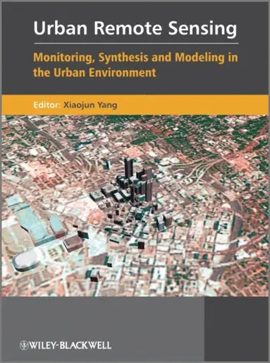

Urban Remote Sensing
Monitoring, Synthesis and Modeling in the Urban Environment
1 008 kr
Tillfälligt slut. Bevaka för att få ett mejl när produkten kan beställas.
Fler format och utgåvor
Beskrivning
Produktinformation
- Utgivningsdatum:2011-04-05
- Språk:Engelska
- ISBN:9780470979563
- Förlag:John Wiley & Sons Inc
- Dimensioner:224 x 290 x 25 mm
Utforska kategorier
Mer om författaren
Xiaojun Yang has authored or co-authored more than 70 publications including two edited volumes on urban remote sensing. He was a guest editor for ISPRS Journal of Photogrammetry and Remote Sensing, Photogrametrical Engineering and Remote Sensing, International Journal of Remote Sensing, and Computer, Environment and Urban Systems. Yang has been involved in organizing urban remote sensing sessions at the annual meetings of the Association of American Geographers (AAG) since 2001. This series of events has become a major urban remote sensing forum in USA. Yang currently serves as Chair of Commission on Mapping for Satellite Imagery, International Cartographic Association (ICA).
Recensioner i media
“This book is a great addition to the very few books on urban remote sensing.” (Photogrammetric Engineering and Remote Sensing, 1 March 2013)"This excellent textbook provides a thorough grounding in the uses and types of remote sensing techniques employed for analyzing population, energy use, and other aspects of the urban environment." (Book News, 1 August 2011)
Innehållsförteckning
- List of Contributors xiiiAuthor’s Biography xviPreface xixPART 1 INTRODUCTION 11 What is urban remote sensing? 3Xiaojun Yang1.1 Introduction 41.2 Remote sensing and urban studies 51.3 Remote sensing systems for urban areas 61.4 Algorithms and techniques for urban attribute extraction 71.5 Urban socioeconomic analyses 71.6 Urban environmental analyses 81.7 Urban growth and landscape change modeling 8Summary and concluding remarks 9References 10PART 2 REMOTE SENSING SYSTEMS FOR URBAN AREAS 132 Use of archival Landsat imagery to monitor urban spatial growth 15Xiaojun Yang2.1 Introduction 162.2 Landsat program and imaging sensors 162.3 Mapping urban spatial growth in an American metropolis 182.4 Discussion 273 Limits and challenges of optical very-high-spatial-resolution satellite remote sensing for urban applications 35Paolo Gamba, Fabio Dell’Acqua, Mattia Stasolla, Giovanna Trianni and Gianni Lisini3.1 Introduction 363.2 Geometrical problems 363.3 Spectral problems 383.4 Mapping limits and challenges 383.5 Adding the time factor: VHR and change detection 393.6 A possible way forward 393.7 Building damage assessment 43Conclusions 46References 474 Potential of hyperspectral remote sensing for analyzing the urban environment 49Sigrid Roessner, Karl Segl, Mathias Bochow, Uta Heiden, Wieke Heldens and Hermann Kaufmann4.1 Introduction 504.2 Spectral characteristics of urban surface materials 504.3 Automated identification of urban surface materials 544.4 Results and discussion of their potential for urban analysis 58References 605 Very-high-resolution spaceborne synthetic aperture radar and urban areas: looking into details of a complex environment 63Fabio Dell’Acqua, Paolo Gamba and Diego Polli5.1 Introduction 645.2 Before spaceborne high-resolution SAR 645.3 High-resolution SAR 66Conclusions 70Acknowledgments 70References 706 3D building reconstruction from airborne lidar point clouds fused with aerial imagery 75Jonathan Li and Haiyan Guan6.1 Lidar-drived building models: related work 766.2 Our building reconstruction method 776.3 Results and discussion 85Concluding remarks 89Acknowledgments 90References 90PART 3 ALGORITHMS AND TECHNIQUES FOR URBAN ATTRIBUTE EXTRACTION 937 Parameterizing neural network models to improve land classification performance 95Xiaojun Yang and Libin Zhou7.1 Introduction 967.2 Fundamentals of neural networks 967.3 Internal parameters and classification accuracy 1007.4 Training algorithm performance 1057.5 Toward a systematic approach to image classification by neural networks 1078 Characterizing urban subpixel composition using spectral mixture analysis 111Rebecca Powell8.1 Introduction 1128.2 Overview of SMA implementation 1128.3 Two case studies 118Conclusions 124Acknowledgments 126References 1269 An object-oriented pattern recognition approach for urban classification 129Soe W. Myint and Douglas Stow9.1 Introduction 1309.2 Object-oriented classification 1309.3 Data and study area 1339.4 Methodology 1349.5 Results and discussion 137Conclusion 139References 14010 Spatial enhancement of multispectral images on urban areas 141Bruno Aiazzi, Stefano Baronti, Luca Capobianco, Andrea Garzelli and Massimo Selva10.1 Introduction 14210.2 Multiresolution fusion scheme 14410.3 Component substitution fusion scheme 14410.4 Hybrid MRA – component substitution method 14610.5 Results 147Conclusions 152References 15211 Exploring the temporal lag between the structure and function of urban areas 155Victor Mesev11.1 Introduction 15611.2 Micro and macro urban remote sensing 15611.3 The temporal lag challenge 15711.4 Structural–functional links 15711.5 Temporal–structural–functional links 15911.6 Empirical measurement of temporal lags 159Conclusions 161References 161PART 4 URBAN SOCIOECONOMIC ANALYSES 16312 A pluralistic approach to defining and measuring urban sprawl 165Amnon Frenkel and Daniel Orenstein12.1 Introduction 16612.2 The diversity of definitions of sprawl 16612.3 Historic forms of ‘‘urban sprawl’’ 16812.4 Qualitative dimensions of sprawl and quantitative variables for measuring them 169Conclusion 178References 17813 Small area population estimation with high-resolution remote sensing and lidar 183Le Wang and Jose-Silvan Cardenas13.1 Introduction 18413.2 Study sites and data 18513.3 Methodology 18613.4 Results 187Discussion and conclusions 192Acknowledgments 192References 19214 Dasymetric mapping for population and sociodemographic data redistribution 195James B. Holt and Hua Lu14.1 Introduction 19614.2 Dasymetric maps, dasymetric mapping, and areal interpolation 19614.3 Application example: metropolitan Atlanta, Georgia 200Conclusions 205Acknowledgments 208References 20815 Who's in the dark-satellite based estimates of electrification rates 211Christopher D.Elvidge, Kimberly E. Baugh, Paul C. Sutton, Budhendra Bhaduri, Benjamin T. Tuttle, Tilotamma Ghosh, Daniel Ziskin and Edward H. Erwin15.1 Introduction 21215.2 Methods 21215.3 Results 21315.4 Discussion 214Conclusion 223Acknowledgments 223References 22316 Integrating remote sensing and GIS for environmental justice research 225Jeremy Mennis16.1 Introduction 22616.2 Environmental justice research 22616.3 Remote sensing for environmental equity analysis 22716.4 Integrating remotely sensed and other spatial data using GIS 22916.5 Case study: vegetation and socioeconomic character in Philadelphia, Pennsylvania 230Conclusion 234References 235PART 5 URBAN ENVIRONMENTAL ANALYSES 23917 Remote sensing of high resolution urban impervious surfaces 241Changshan Wu and Fei Yuan17.1 Introduction 24217.2 Impervious surface estimation 24217.3 Pixel-based models for estimating high-resolution impervious surface 24317.4 Object-based models for estimating high-resolution impervious surface 249Conclusions 252References 25218 Use of impervious surface data obtained from remote sensing in distributed hydrological modeling of urban areas 255Frank Canters, Okke Batelaan, Tim Van de Voorde, Jaros?aw Chorma?ski and Boud Verbeiren18.1 Introduction 25618.2 Spatially distributed hydrological modeling 25618.3 Impervious surface mapping 25718.4 The WetSpa model 25818.5 Impact of different approaches for estimating impervious surface cover on runoff calculation andprediction of peak discharges 261Conclusions 270Acknowledgments 270References 27019 Impacts of urban growth on vegetation carbon sequestration 275Tingting Zhao19.1 Introduction 27619.2 Vegetation productivities and estimation 27619.3 Data and analysis 27719.4 Results 28019.5 Discussion 283Conclusions 284Acknowledgments 284References 28520 Characterizing biodiversity in urban areas using remote sensing 287Marcus Hedblom and Ulla Mörtberg20.1 Introduction 28820.2 Remote sensing methods in urban biodiversity studies 28820.3 Hierarchical levels and definitions of urban ecosystems 29220.4 Using remote sensing to interpret effects of urbanization on species distribution 29420.5 Long-term monitoring of biodiversity in urban green areas – methodology development 29520.6 Applications in urban planning and management 296Conclusions 297Acknowledgments 300References 30021 Urbanweather, climate and air quality modeling: increasing resolution and accuracy using improved urbanmorphology 305Susanne Grossman-Clarke, William L. Stefanov and Joseph A. Zehnder21.1 Introduction 30621.2 Physical approaches for the representation of urban areas in regional atmospheric models 30621.3 Remotely sensed data as input for regional atmospheric models 30721.4 Case studies investigating the effects of urbanization on weather, climate and air quality 311Conclusions 316Acknowledgments 316References 316PART 6 URBAN GROWTH AND LANDSCAPE CHANGE MODELING 32122 Cellular automata and agent base models for urban studies: from pixels to cells to hexa-dpi's 323Elisabete A. Silva22.1 Introduction 32422.2 Computation: the raster–pixel aproach 32422.3 Cells: migrating from basic pixels 32422.4 Agents: joining with cells 32722.5 Cells and agents in a computer’s ‘‘artificial life’’ 32822.6 The hexa-dpi: closing the cycle in the digital age 330Conclusions 332References 33223 Calibrating and validating cellular automata models of urbanization 335Paul M. Torrens23.1 Introduction 33623.2 Calibration 33623.3 Validating automata models 339Conclusions 341Acknowledgments 342References 34224 Agent-based urban modeling:simulating urban growth and subsequent landscape change in suzhou, china 347Yichun Xie and Xining Yang24.1 Introduction 34824.2 Design, construction, calibration, and validation of ABM 34824.3 Case study – desakota development in Suzhou, China 35024.4 The Suzhou Urban Growth Agent Model 351Summary and conclusion 354References 35525 Ecological modeling in urban environments: predicting changes in biodiversity in response to future urban development 359Jeffrey Hepinstall-Cymerman25.1 Introduction 36025.2 Predicting changes in land cover and avian biodiversity for an area north of Seattle, Washington 362Conclusions 365Acknowledgments 367References 36826 Rethinking progress in urban analysis and modeling: models, metaphors, and meaning 371Daniel Z. Sui26.1 Introduction 37226.2 Pepper’s world hypotheses: the role of root metaphors in understanding reality 37326.3 Progress in urban analysis and modeling: metaphors urban modelers live by 37326.4 Models, metaphors, and the meaning of progress: further discussions 377Summary and concluding remarks 377Acknowledgments 378Notes 378References 378Index 383